on
Ten Mile Traverse
The trip started, as they sometimes do, after overhearing some planning happening at the Thursday Happy Hour run. Rich was headed out to Frisco to finish the Ten Mile Traverse, a hike (and scramble) across the Ten Mile range from Frisco to Breckenride on a Sunday and looking for company.
So, on Saturday evening, Annie and I packed our bags, set the alarm for a 3am wakeup, and got a few hours of sleep.


A short time later we were in Frisco, meeting Rich, Ben, Laura, and Geoffrey at a parking lot on the west side of Frisco.
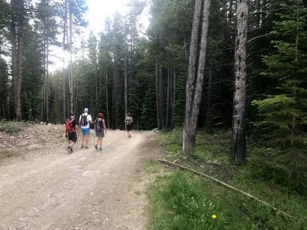
The first half-mile or so was along a multi-use path, then the trail started up the ridge. We hiked and talked for a while, and quickly found ourselves at the top of the first peak on the ridge, looking up towards the next peak on the ridgeline.


We looked off into the distance and saw some darker clouds forming that looked like they could be a problem later.

Ben thought about our current pace, thought about the cloud potential, and decided to go ahead at a faster pace and meet us in Breckenridge.

The top of the ridge had some scree and talus, and one of us, I think Rich, spotted a white spot in the distance that turned out to be a mountain goat.
At some point, I think after the first peak, the trail disappeared and gave way to hiking off trail, including some snow and some scree and talus.


The hike was something I’d been imagining for a long time, since I’ve been looking at the ridge from I70 and from Frisco below for years.

At the first real peak on the summit we met someone who gave us a description of the route. This guy was a much more casual hiker, and it’s not clear what “wall” he was talking about that he was trying to avoid, that caused him to get cliffed out when he went out to the side.


Eventually we got to the goat we’d spotted in the distance. For reasons I can’t remember (or that never existed in the first place), he was named “Scott”. Scott kept a watchful eye on us but didn’t seem very afraid. Maybe he was looking for a snack, or maybe he was just waiting for us to pass by. In any case, we made sure to get some photos of him before moving on.


This was my first technical hike where falling meant some serious injury or more. The scrambling wasn’t hard–had I been a few feet in the air I probably wouldn’t have given the moves very much thought. But since falling looked like a bad idea, I paid attention to what I reached for, where I stepped, and how I moved.


We moved along the ridge and Scott proceeded to follow us. Some of his steps sent some rocks rolling towards us, but aside from looking at us a few times he otherwise ignored us.


The most fun part of the hike was a knife edge that had 30-50ft of exposure on either side (maybe more?) that we took turns crossing and photographing.

Once we got past the knife edge and another scramble up, we got to the “sound of music” hills. This flat, green section of trail marked the end of the technical part of the trail and the start of the flat and rolling part of the trail.

The sky we’d been watching earlier in the morning had now started thundering. We decided a lightning strike wasn’t worth the risk and decided to get down from the ridge.
We looked down the hill for some routes. We couldn’t see whether the closest couloir was overhanging or not, so we continued down the trail to find another.

Eventually we found one we could approach. We stepped onto the snowpack. The snow was firm enough to glissade down, so we set about sliding down the hill on feet and butts, taking pictures along the way.

After a snack we looked for a route to Breckenridge. We couldn’t tell which was the best way to go, nor were we sure where we’d get a ride back to down, so we settled on following the ski lift down, then a service road.


At the bottom of the lift we found a small creek crossing, then sat on a chairlift while we regrouped and planned for the rest of the descent.

Once our group was together we finished the hike down the service road, called a couple of Ubers, and rode into Frisco. We met up with Ben and headed to a restaurant, where we talked about the hike, about some summer plans, and about Ben’s fascination with Via Feratta hiking.